

The Kara Sea is one of the world’s most unwelcoming and rough water bodies. It is a marginal sea of the Arctic Ocean and lies north of Siberia. It is separated from the Barents Sea towards the west by the Novaya Zemlya and the Kara Strait. The Severnaya Zemlya archipelago distinguishes it from the Laptev Sea in the east.
Apart from the Kara, the Barents Sea and the Laptev Sea are also an extension of the Arctic. The Kara Sea is not well-known; however, it is crucial in many aspects.
It is marked by raging storms as intense as the tropical typhoons formed in the southern seas and oceans. The sea is covered with ice for three-quarters of the year, and navigation is challenging, yet essential trade routes pass through it. Its icy cold waters are filled with marine life, and it has two crucial ports as well.
Let’s have a look at the ten fascinating facts about the Kara Sea.
The Kara Sea covers an enormous area covering 340,000 square miles or 880,000 square kilometres. The average depth of the water body is 417 ft or 127 m, and the maximum depth is 2034 ft or 620 m. Its mean depth is around 110 m or 360 ft. It is approximately 1450 kilometres or 900 miles long and 970 kilometres or 600 miles broad.
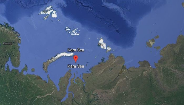

The sea is almost twice as big as Uzbekistan and has shallow waters though it has depressions up to 600 m deep.
The Kara Sea was formed in the last ice age, which began 100,000 years ago and lasted until 25,000 years ago. It was created in the process of deglaciation, which simply means the melting of a glacier or the retreat of an ice sheet in a region.
Small pieces of glacial ice can be seen trapped in some portions of the sea under the thin layer of silty deposition. Dark and Rocky soil and sandbars can be found in the northeastern part of the sea. The coasts of the sea are also covered with fine sand and silt.
The Kara Sea is situated on the Siberian Shelf, and hence 40% of its waters are less than 50 m deep. Only 2% of the sea is about 1600 ft or 500 m deep. In the north, the shelf is divided by two deepsea troughs, namely the 2034 ft deep Svyatoy Anny, which lies east of the Franz Josef Land. The Voronin trough runs parallel to the sea and runs 180 miles towards the east with a 450 m depth.
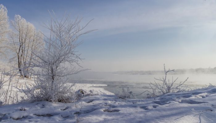
The Kara Sea witnesses extreme temperatures making it one of the world’s coldest seas. Most of the year, it is covered with ice, and ships can sail only in August and September.
The sea witnesses strong winds and blinding snowstorms in winter, while summers bring snowfall and fog. The water temperature in summers is generally below 0 degrees in summer, and it increases in the warmest months, that too at the mouth where the rivers meet the sea.
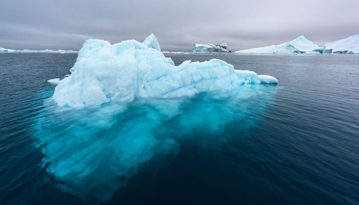

In some parts of the sea, ice sheets as thick as 3 to 4 m can be seen. These never melt at all and provide shelter to seals, walruses, penguins and polar bears.
The maximum temperature of the Kara Sea is 16 degrees Celsius, while the minimum can be as low as -46 degrees Celsius. The temperature increases to 5 or 6 degrees in June, from -27 to -20 in January.
The waters of the Kara Sea have different levels of salinity, and it varies greatly. Near the mouth of the Ob and Yenisey rivers, the salinity is about 10 to 12 ppt as the sea gets abundant freshwater from the rivers. However, near Franz Josef Land, the salinity is 33 ppt.
Also, the water mass is cold and quite stratified. Water temperature in winter averages -1.5 degrees Celsius, and in summer, it goes to 6 degrees Celsius in the southwestern part of the Kara Sea and 2 degrees Celsius in the northern part.
Also, the water and wind circulation patterns in the sea are quite complex. Currents move in two counterclockwise rotations and are quite slow. They usually circulate in the southwestern and northeastern portions.
The Kara Sea is called by many other names, such as the Russian Karskoye or the Karskoje More. It was once known as the Mare Glaciale and the Oceanus Scythicus in the 15th to the 16th centuries and was represented by either of the two names on the geographical maps of those times. In a few 17th-century documents, the sea was called Narzemsky.
It was then named after the river Kara, which flows into Baydaratskaya Bay. It is an insignificant water body politically but once played a crucial role in the Russian conquest of North Siberia. In the Turkish language, Kara means black, and it symbolises the north.
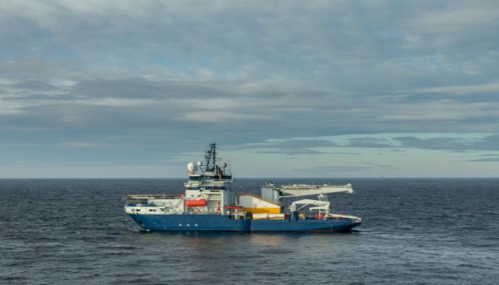

On the other hand, the name of the river is derived from a Nenets word which means hummocked ice.
In Tatar and Bashkir, the sea’s name is an exonym and translates to the Black Sea. Hence, the sea is also called Kara Deniz.
The northern sea route is the shortest maritime route linking the Far East with the European part of Russia and lies along the Kara Sea. Two major ports in the Kara Sea are Dikson and Novy Port which export furs, foodstuff, timber, building material and fish during the two months when the sea is not completely frozen.
Dikson port lies on the southeastern part of the Kara Sea, close to Enisey Bay and the northern sea route. It is operational from June until October and handles containers, vehicles, tractors, coal, sand and gravel, timber, wood and packed food. Approximately 130,000 tonnes of cargo pass through it annually.
Novy port lies at the mouth of the Ob river and has a fish factory. It mainly exports fish and fish products. In the 1930’s it served as a coal bunkering facility for ships traversing the northern route.
Founded in 1993, the Great Arctic State Nature Reserve is unique and one of a kind. It is in Russia and includes 4000 square kilometres of Kara Sea islands.
The Kara Sea has many islands that differ greatly in topography and geography. Some have high mountain peaks, others are covered with ice, and others are sandy.
The largest island group in the sea is the Nordenskiold Archipelago comprising over 90 islands divided into five subgroups. One of the most prominent islands is the Vize which was discovered in 1930. Other islands include the Izvestia Tsik Islands, Oleni, Kirov Islands, Voronina Island, Dikson, Taymyr and Arkticheskaya Islands. The only glaciated island is Ushakov.
Most of the sea is covered with ice and freezes in winter; however, it thrives with life. Aquatic animals and plants are found in abundance. About 54 species of fish are found in the Kara Sea.
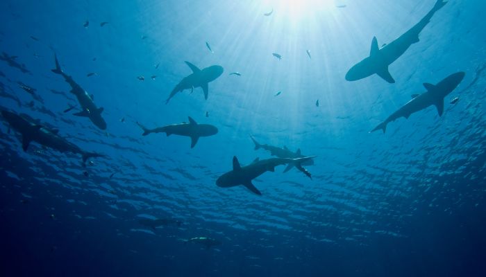
Fishing is done in the two months of August and September. The Kara Sea has molluscs, salmon, sharks, cod, billfish, anchovies, herring, tuna, rays, sturgeons and white whales.

Several mammals, like the King of the Arctic- Polar bears, can be seen at the edge of the sea hunting fish and seals. Polar hares, walruses, and seals also live and thrive here.
Quite a few species of zooplankton are found in the Kara Sea.
Per reports, the Kara Sea suffers from the effects of nuclear waste dumped into it during the cold war era. Radioactive waste from 14 nuclear reactors and 19 vessels, a k-27 nuclear submarine and over 700 heavy machinery parts with radioactive material was thrown into the water by the erstwhile Soviet Union. Later, it was polluted by Russia.
This nuclear waste is a threat to nations like Norway and Finland, but the largest threat is to Russia. However, the Russian government has yet to take any significant steps to prevent or stop additional dumping into the waters of the Kara Sea.
However, Bellona, a non-profit organisation based in Russia, is trying to bring the issue of nuclear waste dumping into the Arctic region to the centre stage. It strives to solve this environmental issue with the help of other countries.
The Kara Sea has become famous lately due to the discovery of natural gas reserves and significant petroleum reserves close to the Ob and Yenisey rivers. These deposits are being explored and have not been developed for commercial purposes.

This discovery has prompted the Russian government to clean the waters of the sea and remove nuclear waste to explore these rich reserves on the kara seabed.
You might also like to read-
Disclaimer: The authors’ views expressed in this article do not necessarily reflect the views of The Marine Learners. Data and charts, if used, in the article have been sourced from available information and have not been authenticated by any statutory authority. The author and The Marine Learners do not claim it to be accurate nor accept any responsibility for the same. The views constitute only the opinions and do not constitute any guidelines or recommendations on any course of action to be followed by the reader.
The article or images cannot be reproduced, copied, shared, or used in any form without the permission of the author and The Marine Learners.





We believe that knowledge is power, and we’re committed to empowering our readers with the information and resources they need to succeed in the merchant navy industry.
Whether you’re looking for advice on career planning, news and analysis, or just want to connect with other aspiring merchant navy applicants, The Marine Learners is the place to be.