
A strait can be defined as a narrow water body or a passage that links two larger water bodies like seas or oceans. It can form through various geological processes, such as a fracture of an isthmus or even tectonic shifts. A strait is also created by a water body overflowing land that has been eroded eventually. The Bosphorus strait came into existence this way.
Straits are essential because they play a vital role in maritime transportation by shortening the sailing duration and reducing shipping costs. Also, nations that control a strait are likely to dominate the shipping routes of that specific area and gain from sea trade and commerce.
While we might be aware of more critical and strategic straits like the Strait of Hormuz, the Strait of Gibraltar and so on, there is another strait that will be discussed in this article, the Kerch Strait.
Let us look at some of the fascinating Strait of Kerch facts you might not know.
Kerch Strait is in Eastern Europe and is the only water body that connects the Black sea with the Sea of Azov, which separates the Kerch Peninsula towards the west from the Taman Peninsula lying in the east.
The former is a part of Crimea, and the latter is situated in Russia’s Krasnodar Krai. Hence, the strait offers a convenient navigable passage to the Azov sea, aiding sea transportation. The Strait of Kerch is about three kilometres long, fifteen kilometres broad, and eighteen metres deep. At its narrowest point, which lies at the northern end of the Chushka Landspit, it is only three to five kilometres wide.
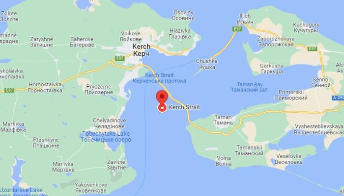

The Kerch-Yenikalsky canal, constructed in 1877 and once operated by Ukraine, is the only passage through the Kerch Strait that can be used by larger vessels. Small ships and ferries used the fairway passages located on the eastern side of the canal.
Before 2014, more than 8500 vessels used to pass through the Kerch Strait, most of them being Russian and Ukrainian ships. Per reports, this secured about 80 million US Dollars in revenues to the providers of pilotage services in the seaport of Kerch. However, it changed after 2014.
Russia occupied Crimea in 2014 and complicated affairs. The Ukrainian Ministry of Infrastructure passed orders to close the ports in Crimea, including the ports on the banks of the Kerch Strait, the Kerch Fishing Seaport and the Port of Crimea, which was eventually shut down, causing huge financial losses to the country.
These new rules and regulations greatly decreased the number of ships passing through the port of Crimea. Also, the occupation of Crimea was not accepted and recognised internationally. Hence, as a part of its non-recognition policy, the European Union banned ships flying the flag of EU States from paying the Port Authority of Kerch and the Port Authority of Sevastopol.
Ukraine stated to the International Maritime Organisation, in clear terms, that the country cannot guarantee the safety and security of navigation in most harbours of the peninsula and its nearby waters.
According to many, the most important harbour near the strait, the Crimean harbour in Kerch city, gives its name to the strait. Earlier it was known as the Cimmerian Bosphorus Strait. However, it is known by different names locally. It was also called the Strait of Yeninkale after the famous Yeni-Kale fortress in the city.
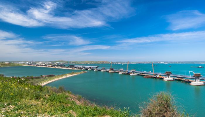

The Romans called it the Strait of Cimmerian Bosphorus. In Greek, it was known as the Cimmerian strait, probably to show respect or honour the steppe nomads of the region. In the ancient days, the low-lying lands near the strait were called the Maeotic Swamp.
The historic city of Kerch, which is also an important seaport in the Crimea Republic, south Ukraine lies on the western banks of the Strait near the head of a tiny bay. It was established in the sixth century BC by Miletan Greeks.
The settlement soon grew into a flourishing trading spot and later became the capital of the dynasty of the Cimmerian Bosphorus. Archaeological finds in the area have found innumerable wealth and riches from catacombs and burial mounds.
It became a part of the Roman Empire and was destroyed by Barbarians, the Huns. Finally, it went under the control of the Mongols, followed by the Genoese.
The city was then known as Korchev, and however, in the fifteenth century, it was conquered by the Turks and finally by the Russians in 1774.
Since times immemorial, Kerch has been an important trading centre in the region. In medieval times, it was a point of stopover for ships heading to Asia or Africa. It had abundant iron ore deposits, which were first exploited in the 19th and 20th centuries.
Smaller factories and metallurgical works came up in 1899, but most of them were destroyed during the second world war. After that, other industries like ore sintering, ship repairs and maintenance, and cast-iron manufacture developed. Fishing and fish processing industries were equally important.
Chuskha Spit is a sandy formation in the northern portion of the Kerch Strait. It spans from Achilleoin Cape towards the southwest in the direction of the Black sea for about 18 km or 11 miles. It is administered by Russia.
It is also important because it creates the northern banks of Taman Bay, whose southern bank is formed by the Tuzla Spit.
Chushka Spit has many branches that spread to the south. It was connected to the Kerch Peninsula in 1944 after the railway bridge was constructed. Port Kavkaz serves as the terminal facility linking the Taman peninsula with Crimea.
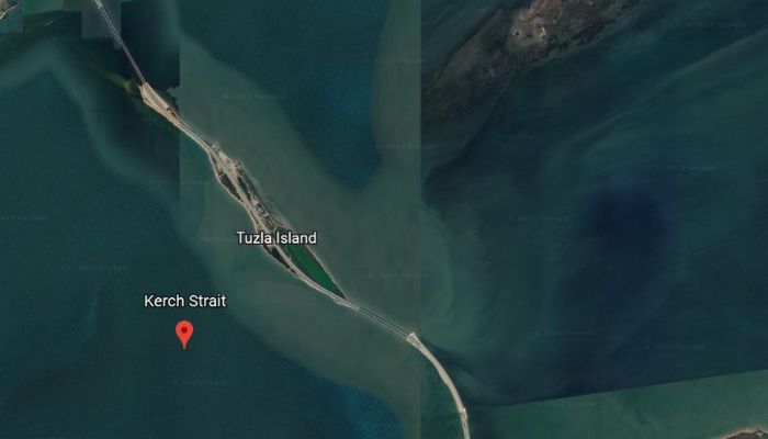

It also houses an old lighthouse which glistens with red light. It is almost 76 feet tall and was built in 1914. Also known as the Kosa Tuzla, the Tuzla spit is another strategic long and narrow peninsula of sand, lying in the eastern portion of Kerch Strait, that spreads from Tuzla Cape to the northwest towards the Kerch city for about eleven kilometres. A strong storm in 1925 cut the spit and led to the formation of Tuzla Island, located amidst the Kerch Strait.
In government records, the island does not have permanent settlements. Still, there is a border station, small fishing villages with some gardens and two-holiday resorts named Albatross and the Two Seas on the island.
Two power stations supply electricity to the island. It also has a wharf for fishing vessels, ferries, boats, and a helipad. A second berth is located near the fishing settlements. It is nearly abandoned and not used now. The island has two main roadways and a supermarket close to the resorts.
It played an essential role while the Crimean Bridge was being constructed. The bridge opened in 2018 and linked Crimea to the Russian Mainland.
The peninsula of Kerch became the scene of combat between Soviet Russia and Nazi Germany during the Second World War. Fighting intensified during peak winter months, and troops of both armies crossed the Strait’s waters on foot, as it was completely frozen.
In 1943, Hitler commanded the construction of a five kilometres long rail bridge to mount a new attack on the Caucasus region. However, the railway or the tramway which became operational could only meet the defence requirements of the German army.
The region experienced frequent earthquakes and tremors, so the bridge required stronger steel girders. However, they could not be supplied as military shipments to Crimea were more important. As a result, the bridge could never be completed.
The next year, the Soviets built a provisional pathway across the strait. The material used in the construction was captured from the German army. The bridge was opened in 1944 but was destroyed the next year by ice floes.
After the war ended, ferry services connected Crimea with Russian Krasnodar Krai. Train services were started, but the old and obsolete train ferries were stopped in the 1980s and removed. In 2004, new vessels were brought, and train transportation began again. Lastly, ferry lines stopped operating in 2020.
The two most important ports on the Kerch Strait are the seaport of Kerch and the port of Kavkaz. The former comes under the jurisdiction of Crimea, and Russia operates the latter.
The Port of Kerch lies in the Kerchenskaya Bay, near the Kerch Strait linking the Black Sea to the Azov Sea. It has two terminals with a total of ten berths having an overall length of 2050 m.
The port handles general cargo like metal goods, equipment, bulk cargo, Ferro-alloys, iron, iron ore pellets and cast iron. Ammonium nitrate, containerised cargo, automobiles, grains, and cereals are also dealt with. The port handles 2,500,000 tonnes of cargo every year.
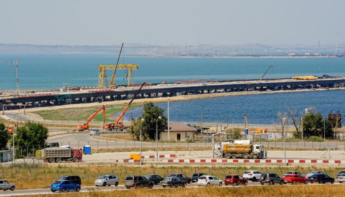

Port of Kavkaz is located on the Kerch Strait in the southern part of Russia. It remains ice-free all year round and offers swift and convenient access to the Black and Mediterranean Sea markets for products like crude, light oil goods, lubricant oils, fuel oils, petrochemicals etc.
It also accommodates RORO and passenger ferries, bulk carriers with mineral fertilisers and other cargo. Over 2000 vessels and 8,230,000 tonnes of cargo and1,50,820 passengers are handled at the facility annually.
As mentioned earlier, the Kerch Strait is the only connecting point between the Black Sea and the Sea of Azov. It is also a migration corridor for marine species, including numerous species of fish, two cetacean subspecies, harbour porpoises and bottlenose dolphins. During spring, the Azov anchovy and harbour porpoises migrate to the large feeding areas of the Azov sea and then come to the Black sea in the autumn.
Taman Bay is the most critical habitat for coastal bottlenose dolphin groups consisting of hundreds of individuals. The main fish in the waters during summers include gobies, anchovy, and mullets, especially red mullet, turbot, sprat, perch, herring and horse mackerel.
Kerch strait and the nearby areas have a humid climate characterised by cool to cold winters and warm and hot summers. During summers, the weather is warm, humid and dry in some areas with clear skies. Winters are usually long and windy, and cloudy.
Throughout the years, the temperature varies between 31°F to 80°F and is hardly below 19°F or more than 87°F. Hence, according to the data, the best time to visit the region is July till the end of August, as the weather is pleasant.
The summer season lasts from June to September, and the hottest month is July. Cold season begins from November till March, the coldest month being February.
The clearest skies are seen in July, and the cloudiest days are in January. November experiences the most precipitation, while it hardly rains in May.
The cities along the Kerch Strait are popular holiday destinations, especially for people living in the nearby regions. They have something for everyone, from beaches to historic churches, resorts, shopping complexes, art museums and so on.
The city of Kerch has many lovely destinations which can be added to one’s bucket list, such as the Adzhimushkay Quarry, the picturesque area of Mitridatskaya Lestnitsa, the stunning Chokral lake, the magnificent Eni Kale fortress and fortress of Kerch, the glistening Tatarka beach and the Kazantypskiy State Nature Reserve.
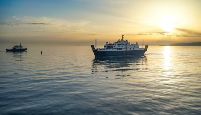

Another famous attraction is the Kerch Strait Bridge, also called the Crimean Bridge. Earlier this month, on October 8th, there was an explosion on the pathway going from Russia to Crimea. A large fire burnt many parts of the bridge, which collapsed. It is currently undergoing repairs and will be opened by the latter half of 2023.
You might also like to read-
Disclaimer: The authors’ views expressed in this article do not necessarily reflect the views of The Marine Learners. Data and charts, if used, in the article have been sourced from available information and have not been authenticated by any statutory authority. The author and The Marine Learners do not claim it to be accurate nor accept any responsibility for the same. The views constitute only the opinions and do not constitute any guidelines or recommendations on any course of action to be followed by the reader.
The article or images cannot be reproduced, copied, shared, or used in any form without the permission of the author and The Marine Learners.






We believe that knowledge is power, and we’re committed to empowering our readers with the information and resources they need to succeed in the merchant navy industry.
Whether you’re looking for advice on career planning, news and analysis, or just want to connect with other aspiring merchant navy applicants, The Marine Learners is the place to be.