
Nestled between India and China, Bhutan lies in the Eastern Himalayan Zone. Rich in biodiversity, it is a melting pot of multiple ethnicities, cultures and cuisines. Bhutan is a developing nation with an annual GDP of over 2.5 billion US dollars and is one of the happiest countries in Asia.
The Kingdom of Bhutan, also known as the Land of the Thunder Dragon, has large water reserves for producing hydroelectricity, the major export commodity. Over 10,000 MW of hydropower is generated from the river valleys and transported to India.
One of the least developed countries in the world with a small economy, Bhutan has experienced GDP growth in the past few years, due to the expanding scope of its hydropower sector, especially with the development of the Tala Hydroelectric plant, established in 2015 with the financial assistance of India, Asian Development Bank and Austria. It also has significant potential for developing solar and wind energy.
Bhutan performs satisfactorily in the human development index. It is a part of many international organisations and a founding member of the regional bloc, SAARC. It ranks first in terms of economic freedom and is one of the least corrupt nations in the region as per the SAARC 2016 report.
Agriculture is the economic mainstay, sustaining over 55 per cent of the population. Crops such as chillies, buckwheat, barley, root crops, apples and maize comprise major produce. Red rice is the most popular agricultural export item, shipped to North America and European nations while most apples and oranges are exported to Bangladesh.
Industries and manufacturing contribute over 20 per cent to the GDP. Major products include ferroalloys, cement, iron, steel goods, graphite, copper conductors, alcohol, beverages, carpets, wood and furniture.
Mineral deposits abound and Bhutan commercially produces coal and stones like gypsum, dolomite and limestone. It also has untapped resources of copper, tin, lead, zinc etc as the nation prefers environmental conservation over mining these resources for money.
The nation’s technology sector is in the juvenile stage. The Thimphu tech park was set up in 2012 for attracting start-ups and multinational companies to Bhutan. Tourism is a major contributor to the economy with over a million tourists visiting the country for its scenic beauty, Buddhist monasteries, historic sites and wildlife sanctuaries.
Lastly, forestry, animal husbandry and small-scale production of handicrafts are vital for the local economy.
Bhutan is landlocked, hence it faces considerable difficulties in carrying out international trade. The cost of imports is high, exports are not competitive enough and foreign direct investment is almost negligible. Bhutan has bilateral trade agreements with India, Thailand and Bangladesh, its major trade partners. The nearest seaport that handles the majority of the Bhutanese import and export trade is Kolkata port, 700 kilometres from Bhutan.
The oldest port of India, the Kolkata port was established by the British East India Company in the 17th century. Consisting of two dock systems, the Kolkata docks and the deepwater berths in Haldia, the harbour serves the expansive hinterland comprising North-East India, Bhutan, Nepal and the Autonomous Region of Tibet. A well-planned facility, it has large storage areas for transit cargo and containers.
Four airports and over 8000 kilometres of roads form the transportation network of the constitutional monarchy. However, weather constraints, unstable ground and frequent landslides damage roads and delay flights.
Also, major drawbacks like lack of finances for repair and maintenance, poor infrastructure, fewer resources, geographical limitations and high trading costs restrict economic growth and overall development.
India has always supported Bhutan in all its endeavours for attaining self-sufficiency and boosting inter-regional trade. The India-Bhutan Trade and Transit Agreement of 1792 established a free trade regime wherein India provided duty-free transit of Bhutanese products to other nations.
When covid disrupted the global supply chains and nations faced shortages of essential items, India shielded Bhutan by accepting increased hydro exports and supporting its economy, an example of their amiable diplomatic relationship. India also aids the kingdom’s latest 12th five-year plan by commissioning a trade facility of 45 billion for increasing bilateral trade and strengthening economic networks.
Bhutan faces the constant challenge of building vital trade infrastructure and a conducive environment for promoting domestic and foreign investments for enhancing trade. Hence, many new trade routes and dry ports are being constructed in Bhutan. Let us have a look at the ports in Bhutan.
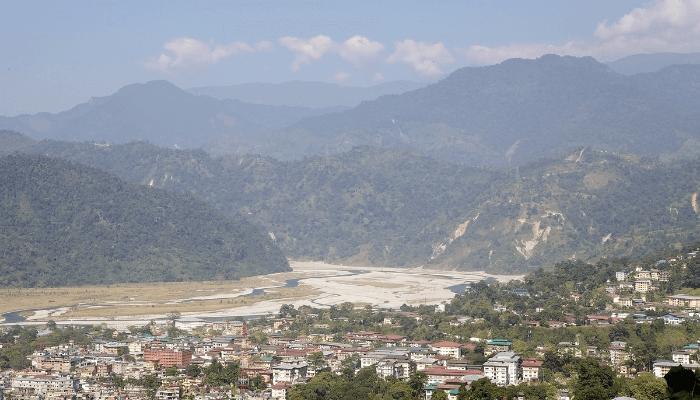
Phuntsholing is the capital of the Chukha district and a major trade hub, industrial and financial centre. Located in southern Bhutan, it serves as a major gateway for trade with India.
One of a kind dry port in Bhutan, it covers 5.48 acres or 2.18 hectares of land area. Built by the Marushin Shitakaka Construction Company, it was funded by the ADB under the
South Asian Subregional Economic Cooperation programme. The 2.075 million dollar project aims to offer better customs clearance and improved facilities for reducing freight transportation costs.

It has a parking lot capable of accommodating around 45 trucks. According to authorities, this facility would decongest the commercial centre of Phuntsholing as trucks carrying goods from the Indian port of Kolkata would not stop at the older customs office in the central district.
The port has a 7 m wide entrance gate and a security house. It also has a weighbridge, covered storage shed for transhipment cargo, a warehouse for keeping dangerous goods like chemicals, a manual inspection area, cold storage for perishables, two administrative buildings, an export warehouse and two warehouses for keeping containers. Seized goods and containers are kept in three separate warehouses, adjacent to the exit gate. It also has a small cafeteria and restrooms for truck drivers and workers.
Apart from the dry port, the SASEC North Bypass Road Project also involves the construction of a 2.8-kilometre road and a 119 m bridge over the River Omchhu. A major component is the development of a land customs area in Pasakha, Bhutan.
Situated in the Alipurduar district of West Bengal, Jaigaon is being developed as an integrated check post, the first on the India-Bhutan international border. It would house the customs department, immigration, and border security while connecting West Bengal with Alhay near Pasakha.
The 16 million dollar project is being funded by the Indian Government as part of the Trade support facility programme. It would cover almost 16 acres of land area divided into three trade zones, the export area, the administrative region and the import facility. It is expected that the dry port would process over 0.327 million TEU by 2035.

Other structures like warehouses, storage yards, roads and a logistics department are also being constructed in Pasakha. The first phase is completed and only two phases are left. As per estimates, the project will be completed by 2024. It will be the biggest dry port in Bhutan and serve the Pasakha industrial estate. The development of this port has generated many employment opportunities as well.
An important point of export, commodities like heavy machinery, project cargo, medical equipment, iron, cement, automobiles, handicrafts, wood, etc are transported to India for shipping through this port. On the other hand, imported items such as silica, calcium carbide, ingots, TMT bars, marble slabs, copper etc are received at Jaigaon and transported through trucks to Pasakha.
Jaigaon enjoys a favourable geographical location and is well-connected with the State highway which joins the Asian Highway, AH-48. Hasimara railway station is closest to the dry port. Though Bhutan lacks railway connectivity, there are plans for linking southern parts of the nation with the Indian rail network.
The Bhutanese Department of trade signed an agreement with India for developing the Gelephu dry port. Other facilities like the construction of a boundary wall, entry-exit gates, security department station, parking spaces, internal roads, administrative buildings, 8 warehouses and drainage works would also be built as part of the 161 million project.
The Gelephu port is envisaged to strengthen bilateral trade between the two countries and provide efficient cargo handling services. After its completion in 2024, it will bring economic prosperity to Bhutan and serve the central and eastern regions. Currently, boulders and aggregates, spices like cardamom and other riverbed materials are transported from Gelephu to India and Bangladesh via the Dubri port in Assam.
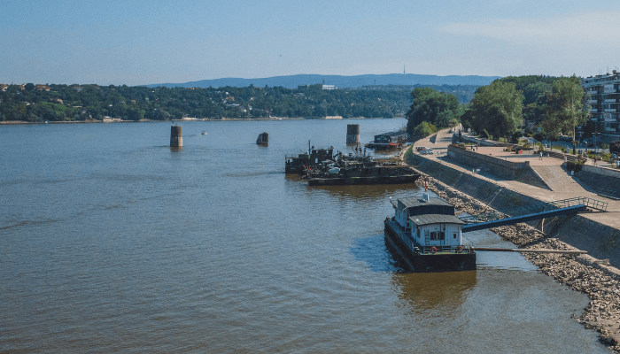

The Jogighopa port in Assam would be transformed into a multi-modal facility for handling this trade, as decided in the 2022 Inland Waterways Conclave held in April. Jogighopa offers many advantages; it is just 100 kilometres from Gelephu and would reduce importation costs manifold. The first phase would be completed by 2023 and enable traders to load commodities from the riverine port.
An added advantage is Gelephu’s proximity to India’s National Waterway II and Asian Highway network. However, it does not have proper infrastructure, storage facilities, security checkpoints, an ICP and an airport.
Bhutan also signed a memorandum of understanding with the Government of Bangladesh for utilising its inland waterways lying on the Brahmaputra.
Samtse is one of the 20 districts of Bhutan known for clay mineral deposits, sustainable agriculture and production of cash crops like areca nuts, cardamom, ginger and citrus fruits.
A dry port covering 61 hectares of land area was constructed close to the integrated checkpoint. The place was strategically chosen so that trucks arriving from Bangladesh and India would not have to pass through the congested towns.
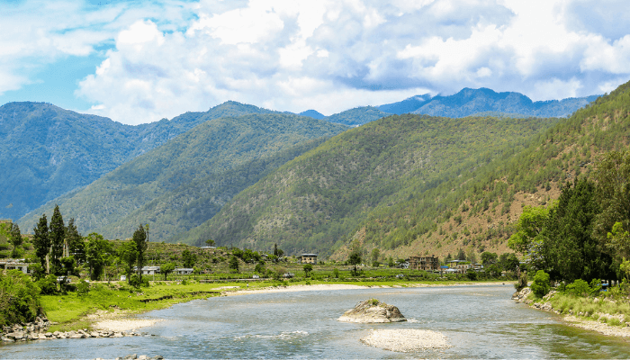

Developed close to the Indian city of Chamurchi, Samtse dry port can accommodate over 40 trucks in its three parking areas. It also has a watchtower for law enforcement agencies.
Twenty-nine acres were allotted to 8 export companies for developing operational areas, transit sheds and warehouses for storing their designated cargo and containers. It also has a 1500 m2 open paved yard for keeping loose cargo.
Amidst the covid pandemic, new trade routes at Agartala, Pandu and Nagrakata were opened by the Indian government for cushioning the Bhutanese economy.
Nagrakata is a port in West Bengal which was transformed into a permanent customs station for Bhutanese freight in 2020. It is connected to Jitti in Bhutan. The facility has separate cargo transit areas, four warehouses and loading platforms for transferring goods from ships to trucks and river barges. Before covid struck, the port handled only seasonal fruits and specific commodities like ginger and spices but now all kinds of goods destined for Bhutan are received here.
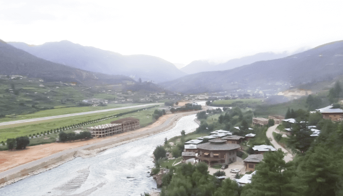

Another important trade point is the Pandu port, located in Guwahati, Assam. Situated on the National Waterway along the river Brahmaputra, this port was opened without any commodity restrictions to conduct trade through Samdrup Jongkhar in Bhutan.
For facilitating the export of construction material, stones and minerals to Bangladesh, India offered the use of Agartala port located in the northeastern state of Tripura. The port is linked to Akhaura in Bangladesh through waterways and railways for conveniently transporting Bhutanese goods.
You might also like to read:
Disclaimer: The authors’ views expressed in this article do not necessarily reflect the views of The Marine Learners. Data and charts, if used in the article, have been sourced from available information and have not been authenticated by any statutory authority. The author and The Marine Learners do not claim it to be accurate nor accept any responsibility for the same. The views constitute only the opinions and do not constitute any guidelines or recommendations on any course of action to be followed by the reader.
The article or images cannot be reproduced, copied, shared or used in any form without the permission of the author and The Marine Learners.






We believe that knowledge is power, and we’re committed to empowering our readers with the information and resources they need to succeed in the merchant navy industry.
Whether you’re looking for advice on career planning, news and analysis, or just want to connect with other aspiring merchant navy applicants, The Marine Learners is the place to be.